

-
Where is Bryce Canyon National Park located?
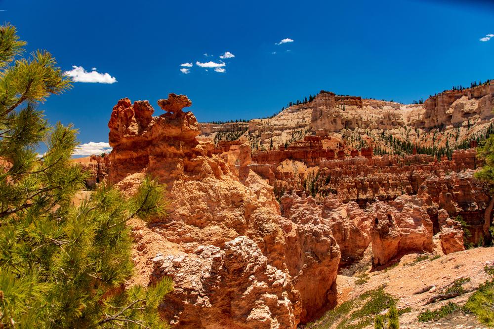
- Bryce Canyon National Park spans 56 square miles throughout southern Utah.
-
What is Bryce Canyon National Park best known for?
- The park is best known for its unique hoodoo rock formations, which were formed by the erosion of natural rock arches breaking apart into spires.
-
When was the park established?
- The park was established in the 1920s to protect its exceptional natural beauty.
-
How many visitors does the park receive annually?
- Bryce Canyon National Park receives more than 2.3 million annual visitors.
⮕ Walk Among the Ancients on the Bristlecone Loop Trail
Easy and scenic, this forested loop offers ancient pines and far-reaching vistas
Bristlecone Loop Trail is an easy mile-long loop trail near Kanab that is recommended for hikers of all skill levels. The trail is accessible via Rainbow Point near the park’s southern end and gains an elevation of 88 feet, taking visitors to the park’s highest region, which peaks at over 9,100 feet. It traverses past historic bristlecone pine trees aged up to 1,800 years old, along with a rich blue spruce, Douglas, and white fir tree forested region.
Along the way, visitors have chances to see woodpeckers, owls, ravens, Steller’s jays, and other native bird species. Visitors should note that the Bristlecone Loop Trail may be inaccessible between December and March due to the region’s heavy annual snowfall.
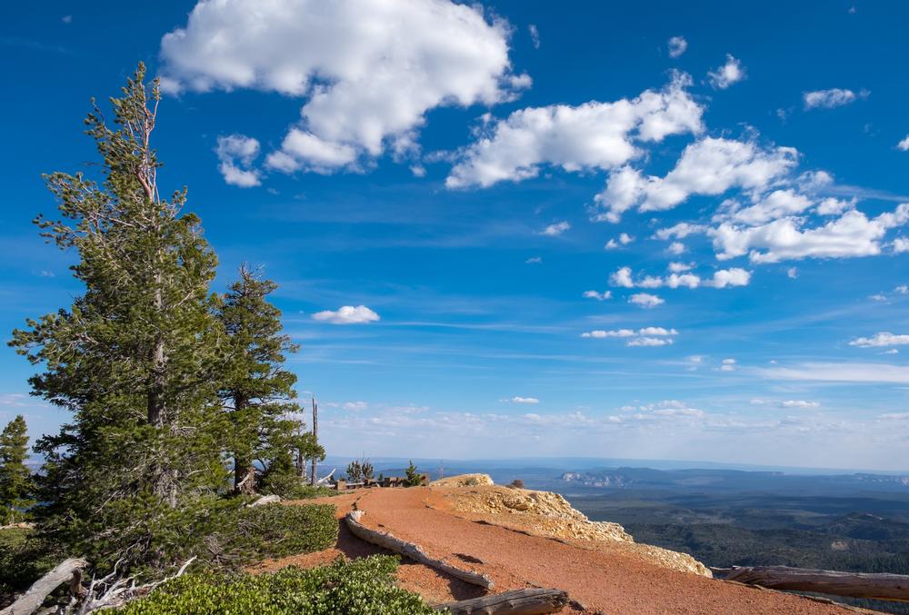
⮕ Watch the World Unfold from Bryce Point Trail
Short but dramatic—panoramic views and sunrise brilliance await at the canyon’s edge
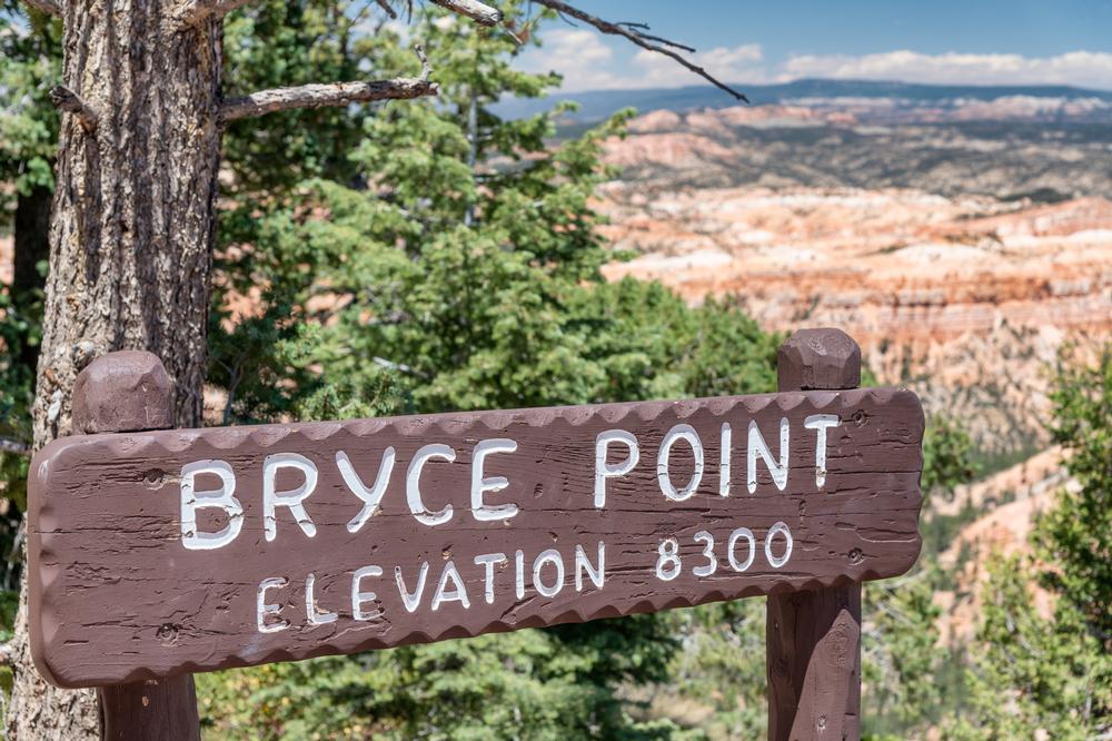
Bryce Point Trail is a heavily-traversed 0.2-mile trail that offers stunning views of the Bryce Amphitheater for hikers and tourists of all skill levels. The easy out-and-back trail is paved its entire length, offering access for families with young children in town and visitors with disabilities. Newly-installed safety fencing also provides additional comfort.
Bryce Point Trail is used by a number of National Park-led nature trips and walks and offers chances for bird watching along the way. Visitors should note that the trail may be closed during the winter months without notice due to icy pavement conditions. Dogs are not permitted on the trail at any time.
⮕ Lose Yourself in Hoodoo Wonderland on the Fairyland Loop Trail
A lesser-known gem offering solitude, sweeping views, and whimsical formations
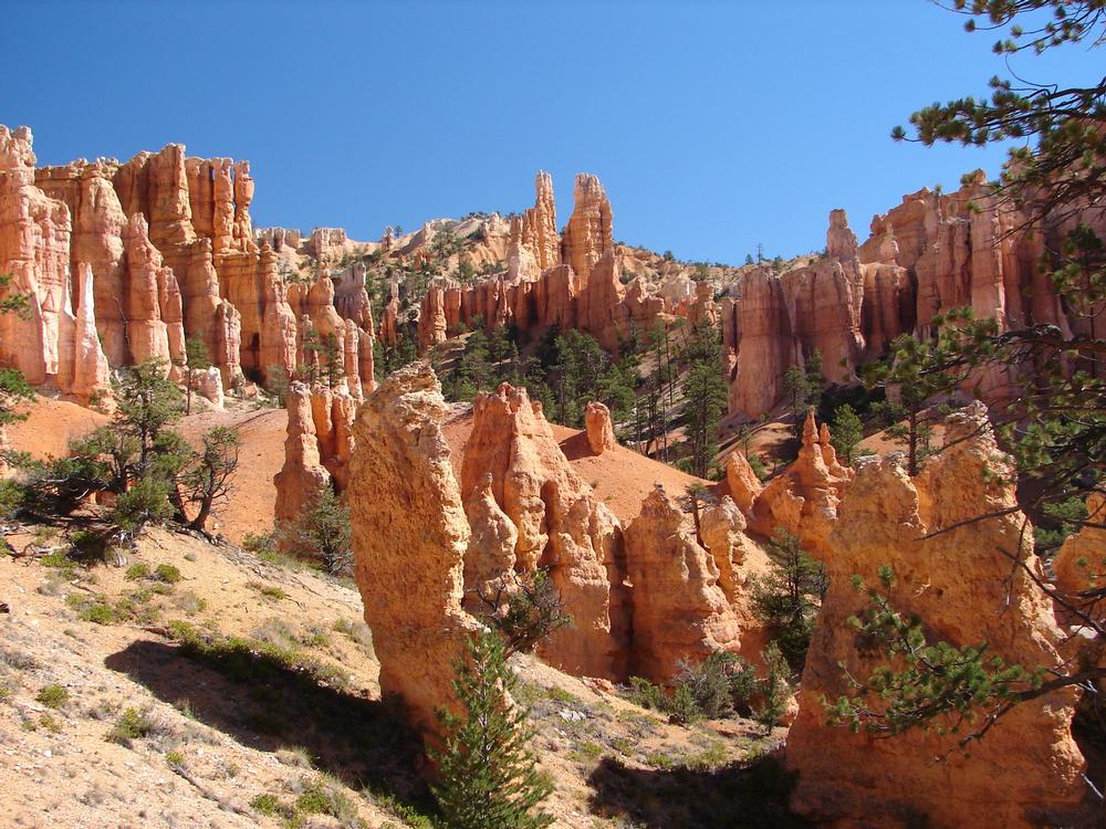
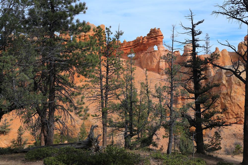
Fairyland Loop Trail is a 7.4-mile moderately difficult trail that embarks at Fairyland Point in the park’s northern end. The trail gains an elevation of 1,545 feet throughout its loop route and typically takes approximately four to five hours to complete. Along the way, visitors have chances to glimpse the park’s spectacular collection of hoodoo spires, which were created by the erosion and separation of natural land bridges.
A portion of the Fairyland Loop Trail combines with the nearby Rim Trail between Fairyland and Sunset Points. As one of the park’s longest individual-trail hikes, visitors are encouraged to bring water on their trips and exercise proper hiking caution throughout their trip.
⮕ Discover Hidden Wonders on Hat Shop and Pink Cliffs via Under The Rim Trail
Backcountry beauty with colorful formations and hoodoos topped like hats
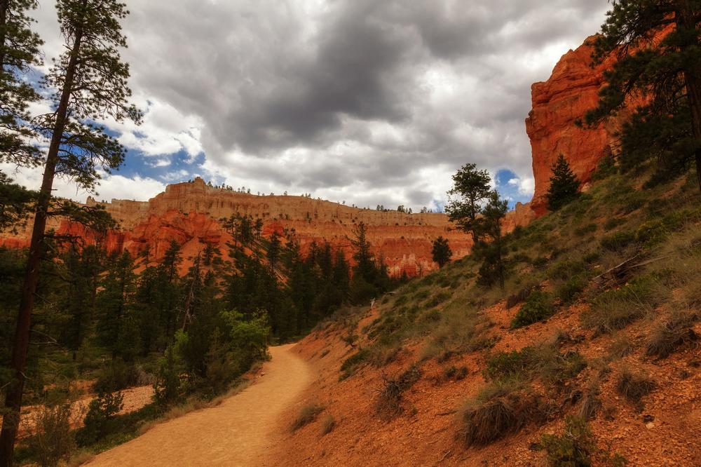
Hat Shop And Pink Cliffs Via Under The Rim Trail is an 11.8-mile point-to-point trail that is rated as moderately difficult and is not advised for beginner hikers due to steep descents along its route. The trail begins at Bryce Point and descends more than 3,000 feet throughout its length.
It traverses noted park sights such as the beautiful Hat Shop hoodoo cluster within the Pink Cliffs region of the park, offering chances to explore less-trafficked areas of the park and take in scenery without large groups of tourists around. Visitors should note that the trail’s return is mostly uphill and that its difficulty level increases significantly throughout the winter months, with foot traction devices strongly recommended for hikers still attempting the route. Map
⮕ Hike the Classics from Inspiration Point to Queens Garden
An epic traverse through Bryce’s best, connecting two of its most iconic viewpoints
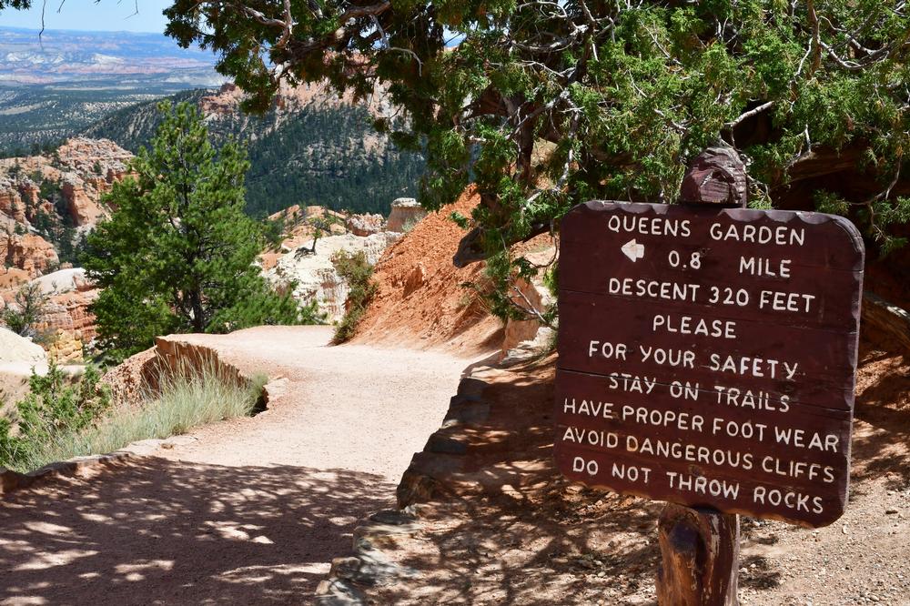
Inspiration To Queens Garden Using Park Trail is a 2.8-mile point-to-point trail that is a variation of the more popular Queens Garden Loop, which is often highly crowded during peak seasons. A park shuttle loads near the park’s entrance and visitor center and takes hikers to Inspiration Point, which offers a stunning scenic overlook. It then traverses toward Sunset Point along a mostly level route before passing Navajo and Queens Garden and ending back at the park’s General Store, gaining an elevation of 587 feet along the way. Views of park sights such as Silent City are offered, along with opportunities for bird and wildlife watching. Visitors can continue along the park’s scenic driving trail after returning to the parking lot to make a day out of their park exploration. Map
⮕ Cool Off by the Water on the Mossy Cave Trail
A unique combo of desert arches and trickling waterfalls on an easy scenic walk
Mossy Cave Turret Arch and Little Windows Trail is a 0.9-mile trail near Tropic that showcases a dolomite limestone-formed waterfall. The easy trail is recommended for hikers of all ability levels and is most accessible between March and November, though it is hikeable year-round depending on weather conditions. Its straightforward out-and-back route is perfect for travelers with children or hikers with limited exploration looking for a quick scenic trail. It also traverses sights such as Water Canyon, which was partially carved as an irrigation ditch by 19th-century Mormon pioneers, and the Mossy Cave shelter cavern and grotto, which is supplied by an underground spring. During the winter months, beautiful formations of icicles are visible overhanging the cavern. Map
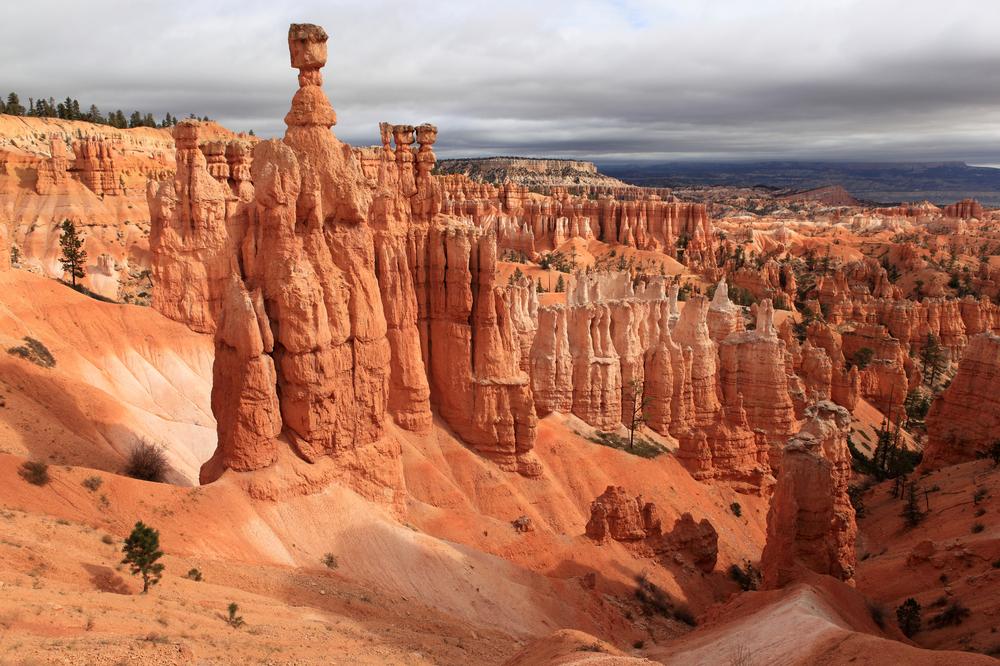
⮕ Experience the Best of Bryce on Navajo Loop and Queens Garden
Iconic switchbacks, Wall Street’s slot canyon, and hoodoos galore in one perfect circuit
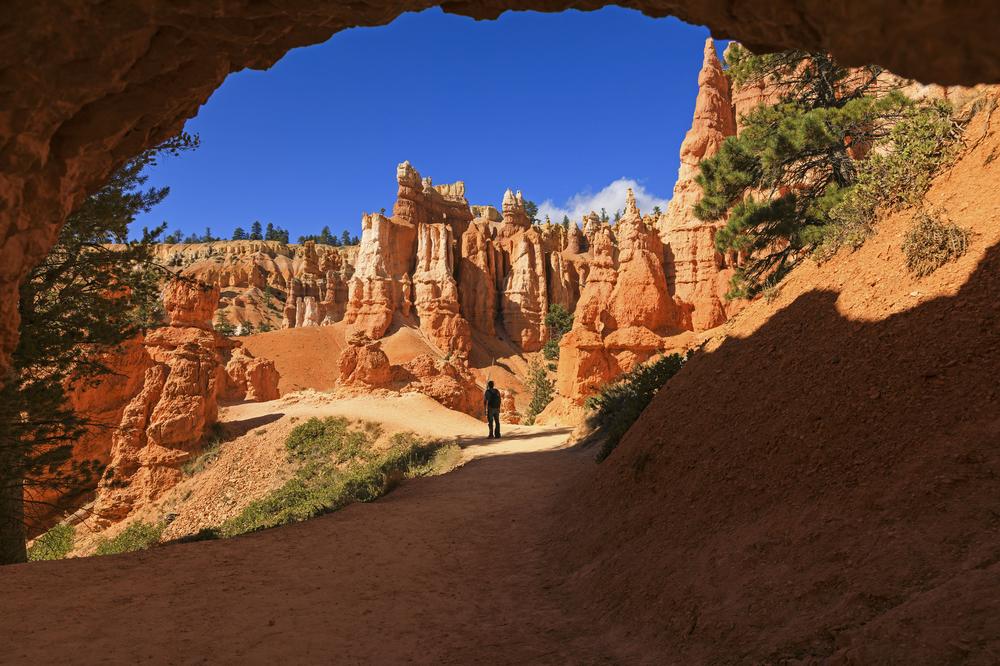
Navajo Loop and Queens Garden Trail combines the popular Queens Garden and Navajo Loop routes into a 2.9-mile hike embarking from Sunset Point. The route serves as a popular combination option to see the national park’s most spectacular sights, including Sunset Point, which serves as its trailhead. From there, it meanders through the Queens Garden Trail until it reaches a four-way intersection at the canyon’s floor. Hikers will want to continue straight at the intersection into the Navajo Loop, which showcases landmarks such as Thor’s Hammer and Two Bridges. After reaching Wall Street, the park’s only slot canyon, the loop returns to Sunset Point. Map
⮕ Step Into the Wild on Paria Trail
Remote and rugged, this under-the-radar trail offers solitude and wide-open beauty
Paria Trail is a quick, easy trail offering a chance to trek out to the park’s noted Paria View overlook, which is noted as a favorite photography spot due to the fact it offers views of hoodoos facing the setting sun. The 0.3-mile hike provides opportunities to look into the Paria River watershed, which is known for its slot canyons carved by rapid runoff erosion. Peregrine falcons are often visible from the overlook, and mules, deer, and elk may be spotted along the trail. Paria Trail gains little elevation along its route, making it an easy trek for novice hikers and visitors with children.
⮕ Twist and Turn Through the Canyon on Peekaboo Loop Trail
Steep climbs and jaw-dropping views make this one of Bryce’s most dynamic hikes
Peekaboo Loop Trail starts at Bryce Point and descends quickly into the heart of the canyon, allowing visitors to explore the canyon’s floor directly. Though the 5.1-mile loop trail’s route is steep and is rated as moderately difficult, it is a popular route due to its spectacular showcase of top attractions within the Bryce Amphitheater, including the Wall of Windows. Hikers should note that the trail is also used by horse and mule riders, who should be given the right of way at all times. Due to the trail’s terrain and rapid elevation changes, hikers are advised to wear sturdy footwear, carry water and snacks, and exercise caution using the trail during the winter months.
Plan Your Trip